Main Navigation
PCM Tools
Pro Cycling Manager 24
Pro Cycling Manager 23
Pro Cycling Manager 22
Pro Cycling Manager 21
Pro Cycling Manager 20
Pro Cycling Manager 19
Pro Cycling Manager 18
Pro Cycling Manager 17
Pro Cycling Manager 16
Pro Cycling Manager 15
Pro Cycling Manager 14
Pro Cycling Manager 13
Pro Cycling Manager 12
Pro Cycling Manager 11
Pro Cycling Manager 10
Pro Cycling Manager 09
Pro Cycling Manager 08
Pro Cycling Manager 07
Pro Cycling Manager 06
Oh no! Where's the
JavaScript ?
Your Web browser does not have JavaScript enabled or does not support JavaScript. Please
enable JavaScript on your Web browser to properly view this Web site,
or
upgrade to a Web browser that does support JavaScript;
Firefox ,
Safari ,
Opera ,
Chrome or a version of
Internet Explorer newer then version 6.
GPS KICKER V06 release
impish
Posted on 14-02-2009 14:34
Junior Rider Posts: 46Joined: 18-07-2007PCM$: 200.00
Here the first release.https://www.livesports.at/GPStoXML_Kic...er_V06.xls
Halvor
Posted on 06-06-2009 15:35
Sprinter Posts: 1755Joined: 18-09-2007PCM$: 200.00
What GPS-files works? I have a Garmin Edge 705, but the program doesn't find any files. The files are .TCX. What do they have to be, and how do I fix it?
CrueTrue
Posted on 06-06-2009 15:43
Tour de France Champion Posts: 27880Joined: 20-10-2006PCM$: 200.00
https://pcmdaily.c...ad_id=6972
Halvor
Posted on 06-06-2009 16:39
Sprinter Posts: 1755Joined: 18-09-2007PCM$: 200.00
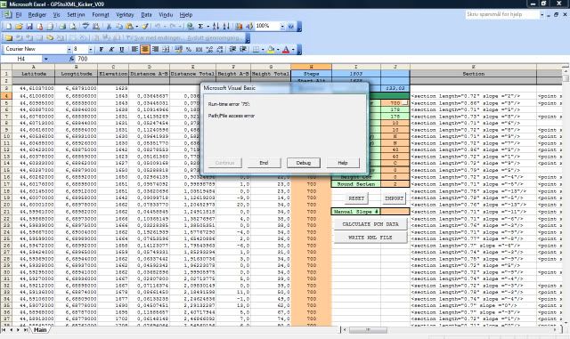
Thanks CrueTrue. I got through everything, then this happened...
CrueTrue
Posted on 06-06-2009 18:25
Tour de France Champion Posts: 27880Joined: 20-10-2006PCM$: 200.00
Please stick to the other thread
Jump to Forum:
PCM 24: General
PCM 24: PCM.daily Projects
PCM 24: Databases, Graphics, Stages
Tour de France 2024
PCM 23: General
PCM 23: Online
PCM23: Technical Issues
PCM 23: Database
PCM 23: PCM.daily Projects
PCM 23: Graphics
PCM 23: Stages
Tour de France 2023
PCM 22: General
PCM 22: Online
PCM 22: Technical Issues
PCM 22: Database
PCM 22: PCM.daily Projects
PCM 22: Graphics
PCM 22: Stages
Tour de France 2022
PCM 21: General
PCM 21: Online
PCM 21: Technical issues
PCM 21: Database
PCM 21: PCM.daily Projects
PCM 21: Graphics
PCM 21: Stages
Tour de France 2021
Pro Cycling Manager 2020
Pro Cycling Manager 2019
Pro Cycling Manager 2018
Pro Cycling Manager 2017
Pro Cycling Manager 2016
Pro Cycling Manager 2015
Pro Cycling Manager 2014
Pro Cycling Manager 2013
Pro Cycling Manager 2012
Pro Cycling Manager 2011
Pro Cycling Manager 2010
Pro Cycling Manager 2009
Pro Cycling Manager 2008
Pro Cycling Manager 2007
Pro Cycling Manager 2006
Cycling
Football
Other sports
Games
Everything else..
PCM.daily Awards 2023
PCM.daily Initiatives
Favourable and critical comments
Hi .. welcome!
PCM Story Section
PCM 20: Stories
PCM 19: Stories
PCM 18: Stories
PCM 17: Stories
PCM 16: Stories
PCM 15: Stories
PCM 14: Stories
PCM 13: Stories
Story Games
[Man-Game] The Rules and Announcements
[Man-Game] Teams HQ
[Man-Game] Transfers: Free Agents
[Man-Game] Transfers: Deals
[Man-Game] Transfers: Adverts
[Man-Game] General
[Cont-Man-Game] General
[Man-Game] Discussion
[Man-Game] Results PT/PTHC
[Cont-Man-Game] HC/C1 Results
[Cont-Man-Game] C2HC/C2 Results
[Man-Game] Other Races
[Man-Game] Race Profiles 2024
[Man-Game] Race Profiles 2025
PCM.daily Awards 2019
PCM.daily Awards 2022
PCM.daily Awards 2021
PCM.daily Awards 2018
PCM.daily Awards 2020
PCM.daily Awards 2017
[Man-Game] 2022 Transfers: Free Agents
[Man-Game] Transfers: Free Agents
[Man-Game] Transfers: Free Agents
[Man-Game] Transfers: Deals
[Man-Game] Transfers: Deals
[Man-Game] 2022 Transfers: Deals
[Man-Game] Transfers: Adverts
[Man-Game] Transfers: Adverts
[Man-Game] Transfers: Adverts
[Man-Game] 2022 Transfers: Adverts
[Man-Game] Transfers: Free Agents
[Man-Game] Transfers: Trades and Loans
[Man-Game] Transfer Discussion
[Man-Game] Transfers: Completed Trades
[Man-Game] Race Profiles 2016
[Man-Game] Race Profiles 2019
[Man-Game] Race Profiles 2015
[Man-Game] Race Profiles 2020
[Man-Game] Race Profiles 2021
[Man-Game] Race Profiles 2023
[Man-Game] Race Profiles 2017
[Man-Game] Transfers: Free Agents
[Man-Game] Transfers: Deals
[Man-Game] Transfers: Adverts
[Man-Game] Race Profiles 2018
Not a member yet?
Click here to register.
Forgotten your password?
Request a new one
here .
Latest content
Latest downloads
Recommended downloads
Latest stages Latest shirts Latest tips
Screenshots
Fantasy Betting
ManGame Betting
Copyright © 2006-2023 PHP-Fusion Copyright © 2026 PHP-Fusion IncGNU Affero GPL v3


